Our First Pacific Northwest Tour
This summer of 2021, we started on a life-changing tour, that turned out better than we could have ever expected. Here are our travel logs from our first 3 months as solar-powered bicycle nomads.
Jump to a section
The trip begins, Northern California
Mendocino to the Avenue of the Giants
We set out north along Highway 1, with its epic coastline of cliffs that drop down to the ocean below. Once we got north of Fort Bragg the traffic lessened and the road morphed into easily rideable rolling green hills with serene views of green pastures overlooking the ocean—and wild blackberries if you’re there in summer.
After Westport, the highway turns inland and starts a steep climb to get over the south end of the King Range and connect with Highway 101. This climb was rough, it’s windy, narrow, and steep. We’d climbed steeper ascents with our loaded etandem along the coast before, but nothing had been so steep for such a long time (nearly 10 miles of steady uphill). What made matters worse: Claire is somewhat of a water paranoid person (nicknamed the Water Goblin), and when we started the climb we were heavily loaded with nearly two gallons of extra water! Before a half mile, we had pulled over to dump the excess water: 4 liters would have to appease the Water Goblin on this tour.
We had made it much less distance than we’d imagined. As dusk was approaching we were far from any place that we’d planned to find secluded camping. We took a risk, and went off-road down a small 4-wheeler track to stay the night in our first “stealth camp.”
In the morning, we woke up at dawn to try to prevent being found in someone’s way. We continued the climb but must have started a little too cold because Will’s back almost immediately seized up. Within a few miles of starting to ride, we had to take a long stretching break on the side of the road overlooking a huge forest of Redwood logging land. It was good we stopped because within a few minutes a car pulled up the road holding one of our trailer’s wheels! Apparently we hadn’t fastened it securely enough and probably taking it off-road the night before had loosened it up.
After the helpful driver pulled away, we took a good long look at each other. Were we cut out for this?
We continued the climb and our first real descent down into Legget. Hopping onto 101 here wasn’t bad, there was a decent shoulder, and views of the Eel River as it snakes back and forth below.
We made up some distance, but still didn’t make it as far as we’d planned. Although we didn’t know it at the time, we had made it fairly close to a campground with hiker/biker sites (if you’re not already familiar with these, they are an amazing resource for cycle touring - they don’t take reservations and will never turn you away. There is a great network of them along the whole US Pacific coast). But not knowing where to go, we lucked out and found a very beautiful spot down near the banks of the Eel River for night two of our boondocking tour.
On the third day we woke up and rode almost immediately into the Avenue of the Giants, a scenic route off 101 that travels through the old growth redwoods. It’s magical to bike through these ancient trees - it feels like you’re riding a speeder bike on Endor. Humbolt Redwoods State Park is along this road and has many trails and groves to explore.
Ferndale to Petrolia
Our first scheduled co-op interview was in the Mattole valley along the California coast. But getting there required biking over the north end on the King range on a road that the locals affectionately call the Wildcat and describe it as “super burley.” This proved to be too much for us this early in the trip, with crushingly steep grades coming out of Ferndale, CA. Even with our motor on maximum we were literally stalling out with all our gear. Something was going to have to give. We folded our tail between our legs and headed back down into Ferndale to get a hotel room. But we were determined! We would regroup overnight and find a way up that hill!
By the morning we had a plan. We’d pack our backpacks with as much gear as we could fit to lighten our load, and leave them overnight with the hotel. And it worked! We made it up and over the first half of the Wildcat and were rewarded with gorgeous green mountain meadows.
Here, the road traverses for a while and then drops down into a valley, which means another steep climb out. The second climb turned out to be even steeper than the first. But we knew we were already close enough to our destination that we didn’t need our solar panels for this quick out and back. We found a rancher in the valley and asked if we could leave our solar charging trailer locked up on the side of the road. He obliged us (saying we could leave it next to the broken down car that someone had left in the valley last week) and we made the last climb over to the coast where we got some stunning views of the big blue Pacific and the rocky outcroppings that dot the shoreline.
At this point, when we biked down a ridiculously steep grade known as “the wall” is when we started to get into real trouble. A combination of rough road, heavy tandem bike, and inadequate tires made for frequent flats. After about the third or fourth we started to have trouble patching. Following the road along the coast was absolutely gorgeous but also stressful as we noticed that we had to stop to inflate more frequently. At the turn up the Mattole Valley, we finally just had to stop, expecting that perhaps we’d need to wait it out in a camp on the beautiful (but windy) beach before walking into Petrolia for a bailout the next morning. Fortunately, a friendly surfer stopped on his way up from the beach and offered to grab a new tire for us from his place. Thank you Josh!! This held and kept us moving up into the Mattole valley. As dusk was settling, we turned the corner to find the houses of the tiny town of Petrolia peek up from among the hills as we wound our way inland.
@trailcooperative We rode our tandem on "the Wildcat" to visit the Uplift Cannabis Co-op. A ##burly road but well worth it. ##cycling ##lostcoast ##steep
♬ original sound - SPTC
We were planning to stay with a host Drew from the Uplift Cannabis Co-op so that we could interview him about his cooperative in the morning. We reached him after dark, but he was so kind that he even got up to make Claire pancakes. We woke up in the morning and interviewed him, learning so much about their work with producer cooperatives and growing cannabis in this beautiful place.
We learned so much from interviewing Drew. He taught us about the history of the rural sharing economy, social structure of the Mattole Valley and cannabis farming. It was fascinating to learn about the way the local growers were banding together to fight back against the major industrial players entering the cannabis space. It was also fascinating to learn about the specific ecological factors that made the farms of the Mattole Valley such a unique place to grow cannabis.
Immediately after interviewing Drew, we had to head out because we had a scheduled stop in Arcata that evening. We stopped before leaving Petrolia to find Cedar, who has become known as the town bike mechanic. As far as services go the town has a general store, church, community center and school - so we were extremely lucky to learn about Cedar from someone who saw us patching a tire the day before. He was so gracious, showing us into his workshop (a room of his barn) in between rounds of milking the cows. We bought a few extra tubes from him for the road, saw some of his cool bike builds, and off we went back up and over the Wildcat. But this time, after riding over the range, we continued on all the way to Arcata, for our longest ride thus far (70 miles). We made it to Hoopla farm to stay with our Warmshowers hosts, Evelyn and Wallace on their small farm full of free range chickens, veggies and golden berries (like small sweet tomatoes). It was wonderful to learn about their experience of raising chickens and communal living on their property (there is a tiny house in the back of the main house).
Visiting Cooperatives in Arcata CA
We spent several days in Arcata to explore the place, relax for a while, edit some videos, teach an online course, and interview one of the coolest cooperatives that we’ve ever had the pleasure of meeting. We were so lucky to get to meet the folks who started Full Cycle Compost, a cooperative company that offers curbside compost pickup ON THEIR BIKES, which goes to make compost for community gardens and farms. We filmed one interview about their compost co-op and another on their work and the process of forming as a cooperative.
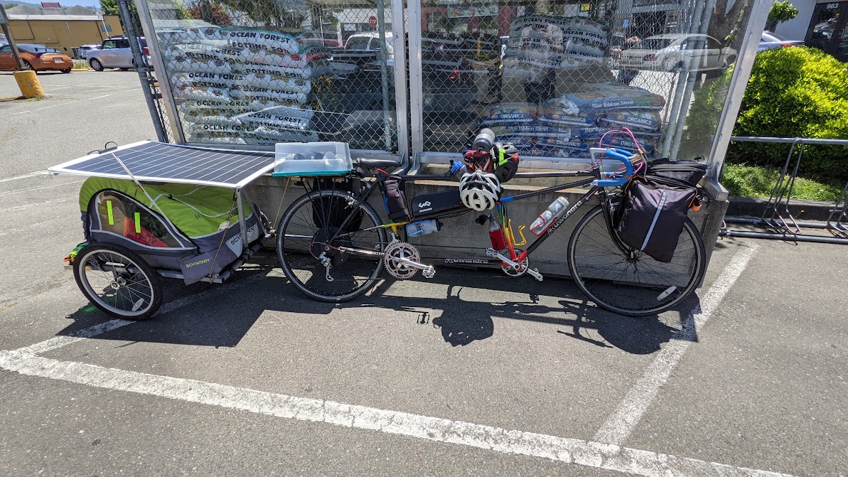
During our time in Arcata, we also made the decision to convert our trailer from two buggies down to one - for both convenience of not having such a long rig and for reducing the weight. To do this, we realized we could just stack our solar panels while riding. We didn’t do that initially because it would halve the amount of power we could get while on-the-go. But overall, that turned out fine because we were still spending plenty of time taking breaks where we could lay both panels out. A smaller rig also meant we had less room for gear, but we were carrying stuff we hadn’t used, so we sent a small box of things back to our family for safekeeping. Then we dropped our trailer off at a local bike collective Moon Cycle. Thanks to their great bike mechanic for also catching that our front brake cable was fraying! It was much better only riding with one trailer and made things a lot easier.
Arcata to CA-OR border
Starting in Arcata, CA we stocked up at the North Coast Co-op, and left via the Hammond Coastal Trail, a local favorite that we learned about from the fantastic folks at Moon Cycles Collective. After about 9 miles, this joined back up with Highway 101, which we rode over two days stopping overnight at the Trinidad North rest area just for a quick sleep.
We turned off Highway 101 again to take the beautiful Newton B Drury Scenic Parkway which travels through the redwoods and leads to the hiker/biker camp at Elk Meadow Campground in Prairie Creek Redwoods State Park. This is one of the best hiker/biker areas we stayed at and highly recommended for the views of the elk herd in the area. This is also Claire’s favorite place to see the giant Redwoods. There are some amazing ones just a short walk from the visitors’ center, and if you’re game for a longer hike, the first 3 miles of the Skunk Cabbage trail have redwoods that will make you feel like a tiny ant.
The next leg of the trip returns to 101 for a somewhat frustrating but necessary ride along a few shoulderless steep stretches. Just after entering Crescent City, take Elk Valley Rd to Jedediah Smith Redwoods State Park for another hiker/biker. At this park, you can also see the rare albino redwoods, which don’t produce chlorophyll in their leaves and instead rely on nutrients from neighboring trees.
It was at this part of the trip that we finally started to feel like we were getting things under control. Our rig was much lighter and we were traveling fast enough to start doing some backpacking trips! We made this short video to explain how we were getting around.
@trailcooperative check out our ##solarpower tandem ##ebike. we want to do ##vanlife with a lower ##carbonfootprint. plus we love ##bicycles. ##sustainabletravel ##slowtravel
♬ original sound - SPTC
Entering Oregon
South Oregon Coast
The whole of the Southern Oregon coast is a beautiful and interesting landscape to ride. The southern portion of this route felt like one of the safer cycling routes compared to other parts of coastal Highway 101.
Just past the first major town across the southern border, Brookings, you’ll find the Harris Beach State Park, another great hiker/biker camp. Alternatively, it is said that despite Oregon beaches being “free to camp,” Brookings is one of the only major cities to allow beach camping so close by (the free beach camping is not allowed within most major cities, nor adjacent to or within any state park - and since most of the coast is state parks, this eliminates a lot of the beaches). If you are so inclined, a tent on the sandy beaches around Brookings could be an interesting way to start a tour into Oregon.
We rode 77 miles of coast from Harris Beach to the small town of Port Orford where we loaded up on delicious locally grown food at the Port Orford Food Co-op. We stayed the night near Port Orford in a dispersed campsite just off Elk River Rd rode along the calm and beautiful Elk Creek in the Grassy Knob Wilderness of the Rogue River-Siskiyou National Forest.
The next leg stretched from Port Orford to Sunset Bay State Park just south of Coos Bay. From Sunset Bay we day tripped into Coos Bay to visit the Coos Head Food Co-op for supplies and paid a visit to the Front Street Community Bikeworks to take care of some maintenance on our bike.
During our time in Port Orford and Coos Bay, we interviewed two coastal co-ops about their history and the strong sense of community they’ve fostered. It was amazing to see how they had used the co-op model not only to bring healthy food to the residents of this rural coast, but also to unite their community around the 7 cooperative principles.
From Sunset Bay, we headed up to Dunes Recreation Area just south of Dune City, where we did our first true overnight backpacking trip! We planned to start at the Tahkenitch Dunes - Threemile Lake North Trailhead and dispersed camp on the dunes along the lake. We weren’t sure how to stash our bikes overnight, but met a friendly camp host at the Tahkenitch Landing Campground across the street who was kind enough to let us park them behind his RV for the night. This was a lovely little trip, we took the long way around to get to the lake which led us to hike along the beach for a bit. Waking up on a high dune overlooking the lake felt magical.
Central Oregon Coast
After a successful overnight trip at Threemile Lake, we started to make backpacking trips a regular part of our travel and it made the trip much more special than just jumping between hiker/biker campgrounds.
Our next stop was Cummins Creek Wilderness Area in the Siuslaw National Forest for a 2 night backpacking trip around the trails. This was another of our favorite areas, covered with beautiful old growth sitka spruce, some of which stretched to 9 feet in diameter.
After hiking out of Cummins Creek, we rode through Florence up the coast to Waldport, where we made extensive use of the Waldport library. The little public libraries in the costal towns quickly became a favorite spot - a quiet place to rest out of the sun, charge phones, check email and refill water bottles. Such an underappreciated resource! This library visit was particularly special because the library director’s husband, John, recognized us as bike tourers and offered to let us camp at his property nearby! He had 6 acres with chickens and ducks and a local herd of Elk which visited that evening. The next morning he made us eggs and showed us the RC cars he has built, many of which have won first place at the Oregon County Fair. Before leaving town, we also paid a visit to the Greenbikes Co-op, a community bike repair shop, where we learned of another couple on a tandem who had toured for 10 years and had two children along the way!
From Waldport, we headed north for a few more miles of 101 before turning off toward Cape Lookout State Park.
Our next destination was Portland and we took two days to cross from Tillamook inland along the Wilson River Highway, with one night at the dispersed camping near Jones Creek Campground and one night at Elk Creek Campground. The Jones Creek day use area was an amazing place for a relaxing day along the river before heading to Elk Creek. Then Elk Creek was awesome because the trail to the first primitive campsite was wide enough for a bike + trailer, so we were able to take everything with us instead of unpacking. The highway along here was not the best for biking, so we would recommend leaving early in the morning to beat traffic and going on a weekday, if you take this route inland.
Portland Co-op Loop
Portland is a town rich with cooperative businesses. During our stay in Portland, thanks to our wonderful Warmshowers hosts Chris and Rosemary, we took a day to do a loop that visited all the co-ops we could pack in.
The loop started in Multnomah Village and proceeded over the beautiful Terwilliger Blvd ride into downtown Portland, passing by the statue Portlandia and many downtown Portland attractions. Next we traveled to the northwest part of the city to get an early lunch at Food Front Co-op.
We crossed the Willamette river at the Broadway Bridge to visit the eastern neighborhoods. We rode north to the Alberta Co-op to grab some blueberries and granola, before heading the roundabout way up to Mt Tabor Park for some views of the city.
From Mt Tabor, we headed west toward the Buckman neighborhood and stopped into the Citybikes worker co-op to restock on new high-quality tires and tubes.
Finally, we stopped into People’s Food Co-op, an amazing store where we grabbed a bottle of local, cooperatively produced wine before heading back to Multnomah Village.
Along the route, we also passed two other worker co-ops that were unfortunately closed during our ride. Common Ground Wellness Co-op, a cooperatively run spa, would surely have been wonderful after our last three weeks of touring. And Mirisata, a Sri Lankan restaurant and worker co-op that we wished we’d have had the chance to eat at, but which is only open a few days per week at the moment. Certainly these will be two locations we look forward to visiting in the future.
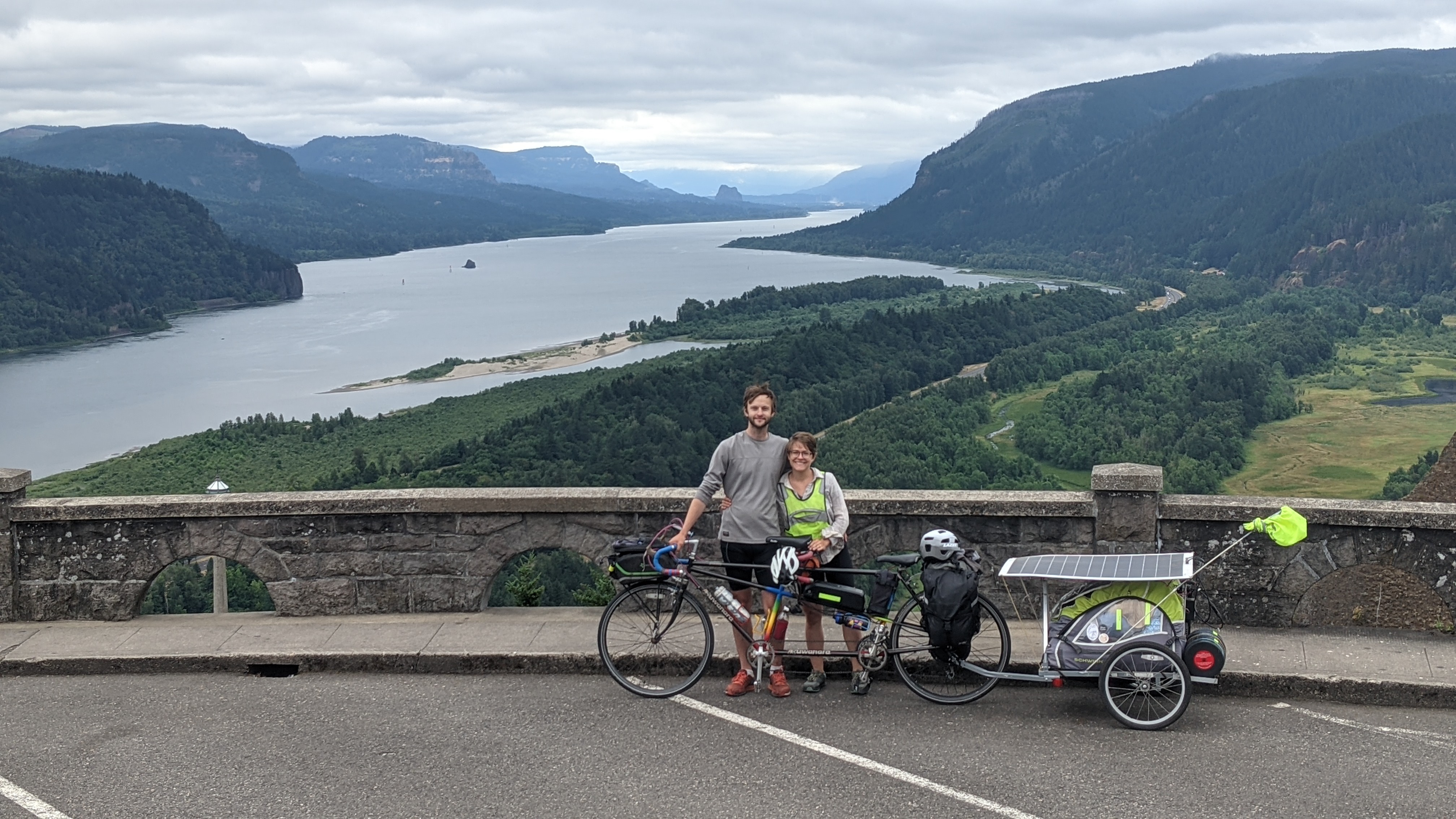
Columbia River Gorge
Heading east from Portland you can catch the Historic Columbia River highway, the first scenic highway built in the US, that runs along the Columbia River Gorge. This is a stunning area, a gaping gorge shaped by basalt flows and massive floods, with the highest concentration of waterfalls in the country. Plus it has a wonderful bike route. The old highway was finished in 1920 and later abandoned when a larger highway was built further down the gorge to handle the high traffic. But the old highway is being restored for tourists and some sections are biking only. After many waterfalls, we stopped at the Bonneville fish hatchery, which you can visit for free, and saw the huge 6ft sturgeon in their ponds. The sturgeon are an ancient-looking fish that haven’t changed much over time and really look like sharks.
We also tried to visit the Bonneville lock and dam, but cyclists and pedestrians are only allowed on the first island to see the locks, you need to be in a vehicle to cross the next bridge to the dam. By coincidence a barge was coming through just as we arrived and we watched the locks in action. Two large barges came through side by side, with only a couple feet of clearance on either side of the channel wall, and millions of gallons of water drained in 20 minutes! But this also made us reflect on what it means to tame the rivers this way, many creatures that depend on the river are affected, for example, the sturgeon populations upstream of the dam are doing much worse than those below the dam.
In terms of camping along the way the Ainsworth State Park has hiker/biker sites, but there are also lots of trails for backpacking into the Mount Hood National Forest. We hiked along Eagle Creek, one of the most popular trails for a good reason. We were so lucky to be able to visit as it had only reopened 5 days ago (it was closed for a few years for fire damage). You’re up along cliffs, with so many waterfalls they don’t all get named, and you can even pass through a tunnel behind one of the falls (aptly named Tunnel Falls). A bit of an adrenaline rush, as you’re also along a cliff which is now slippery as it gets wet. Camping is allowed anywhere past 3.3 miles, where you cross the high bridge. You’ll know it when you see it.
We found the best spots with water access (you’ll want a dip in the cool creek) a mile or 2 further along. After 2 nights we hiked out and continued east. The biking trail has a small set of stairs, but very manageable, and extends to Bridge of the Gods. The scenic bikeway is currently awaiting another section to be built (so bikes can eventually avoid 84 completely), if you want to continue east on the Oregon side.
We crossed to the Washington side of the river at the Bridge of the Gods (this is where the PCT hikers cross too). It has a 15 mph limit for cars, so it felt very safe. However, it puts you out on highway 14, which is akin to 101. We were a little behind schedule at this point and needed a place to camp, so going off a tip from a local, we boondocked at Dog Creek Falls. Then we left very early in the morning to help avoid the trucks.
There are also 2 miles of intermittent short tunnels along 14, which have warning lights that bikers can activate to let cars know there is a bike inside. We did these at 6am and had no trouble. There are craft breweries and wineries throughout this area, well earned after a long days ride. There is also a bit of a reprieve from 14 along Old Hwy 8, east of Bingen. Some boulders have fallen into 8 at the beginning, but it clears up soon. This takes you up, with great views of the Columbia.
Our journey took us to Klickitat, so we took a turn up 142 and followed the swiftly flowing Klickitat river, with views of Mount Hood. Rafters were floating down in the calmer parts and we took a dip to escape the heat. It gets quite hot. There is also a gravel trail but not worth it unless you have a serious mountain bike (really large gravel), we tried and turned around (fyi, cell service drops off as you head up).
Western Washington
Working at Basalt Blossom
As part of traveling in a regenerative way, we wanted to know where our food comes from and contribute to the farms that produce it. Participating in the WWOOF (Worldwide Opportunities on Organic Farms) network provides a fun way to do just that. Our first WWOOF hosts were Scott and Carrie at Basalt Blossom, their off-grid farm and soon-to-be retreat center in Klickitat, WA, where we stayed for 10 days. We learned a lot from working alongside Scott. The coolest project we helped with was installing a gravity-fed irrigation system to water the vegetable plots. The land is quite hilly, so Scott had plans for installing 3 2500-gallon water tanks up on a hill and running pipe down the hill to feed the irrigation lines. With this set-up, all the water pressure comes from the elevation of the tanks - no electric pump is needed! An electric pump is needed to get the water up into the tanks in the first place, and this is done with solar power during the day, but irrigation is best done early in the morning or evening when there isn’t enough sun to power a pump. With this gravity-fed system Scott can now water his farm at the optimal time with just solar power.
With our time off, we enjoyed hiking, a dip in the Klickitat river and reading. A nice reprieve from all the biking!
Scott and Carrie’s vision for Basalt Blossom is actually much more than a farm, they want to reimagine what end of life care could look like. This is a difficult subject and hard but important to talk about so we sat down with Scott to talk about their vision.
Instead of being in hospice in a hospital, Basalt Blossom wants to bring end of life care out into a beautiful oak savannah. Between farm and wilderness walks, elders and their families could enjoy a beautiful serene environment during this important but difficult phase of life. Turning the focus from fear and survival to acceptance and joy. Personally, I still deeply remember the images of my father hooked up to medical machines up to the end of his life. And I would love to offer a different set of memories to my children someday.
High Cascades
Mt Adams and Rainier National Park were two of the highlights of the pacific northwest (the other being the Olympic Peninsula). When it was time to say goodbye to Basalt Blossom, we headed to the Klickitat wilderness area, which has 2 campgrounds that are free for bikers and hikers and are first come first served. The only resupply point in Klickitat is a general store, so resupply earlier if you want certain foods. The road to get to the wilderness area from Klickitat is a pretty but steep ride with minimal traffic that follows the Klickitat River and rises high above the gorge. The Leidel Campground is particularly nice, with spots right along the river. It is large and finding a spot even on a Saturday in summer was easy.
Our goal at this point was to reach Mt Adams for a backpacking trip. In this direction, the only resupply point is in Glenwood, at a general store about 10 miles south of Gifford Pinchot forest. They also serve hot breakfast, coffee and burgers and have free wifi and a portapotty. This section of the ride had great views of Mt Adams, getting larger and larger as we went. After the town of Trout Lake, we took NF-23. When you’re nearing Mt Adams, at the junction of NF-8801 and NF-23, a section of the PCT crosses the road. Here there is a creek 300 ft in on the right side, if you need water or to cool off. We camped just north of here, along the road to the Williams Mine trailhead.
There are many trailheads in the Mt Adams area. We did the Divide Trail, which we highly recommend, but Goat Rocks is supposed to be even better. The Divide Trail has ample places to stash a bike at the trailhead and the hike in is modest elevation, only 5 miles and will reward you with views of Adams, Rainier and St Helens. To get there, the roads are gravel the whole way with roughly 1000 feet of elevation, but very little traffic. There are a few places to camp along the Divide Trail, and High Camp sounds the most enticing, but requires crossing a river that is only foldable in the early morning when snowmelt levels are still low. There are also great spots before the turn to High Camp, explore the little trails off the main one to find them. The other challenge we encountered here was getting water because the swiftly flowing rivers were so silty that it clogged up our water filter. Luckily, we met a fellow hiker who keyed us into a clear stream that lies to the right of the main trail, about 0.3 miles away. Also, be aware of mosquitoes, at least in July, they were brutal. We wore rain jackets and hid in the tent when not actively moving. However, this is supposedly better than the biting fly season later on and July still has lots of wildflowers.
Next we set our sights on Mt Rainier National Park. To get there, Randall and Packwood are 2 food resupply points, with decent grocery stores and a few restaurants. Packwood also has a library, coffee shop and brewery, and is a resupply point for PCT hikers. Getting from the Divide Trailhead to Randall is a nice downhill ride. It’s gravel at first but then paved for 27 of the 35 miles. It is also in the national forest for most of the way and follows the Cispus River, with camping spots along it. If your goal is to get to Packwood, going via Randall seemed easier despite being a little longer. We needed to resupply before Packwood, so went into Randall for food and then back out to some national forest land to camp. Taking 12 to Packwood is flat with a wide shoulder. To approach Rainier from Packwood, Forest Road 52 follows Skate Creek through more National Forest and has lots of camping pull outs along it. This will get you close to the Nisqually entrance in case you want to get up early to try for a walk-in wilderness permit, the office opens at 7:30am. We were lucky to get a permit for 3 nights along part of the Wonderland trail, the trail that circumnavigates the mountain. This was one of the most gorgeous places we have been and would highly recommend it.
The Lake George and South Puyallup camps are perfect for biking in! They are accessed by the West Side Road (closed Nov - May), which closes to cars after 5 miles but is still open to bikes. You can bike to within 0.9 miles of Lake George and there is even a bike rack. The road has a few rough patches but is otherwise passable. On our trek, the highlights were Aurora Peak, (some of the best views!), St Andrew’s lake and Emerald Ridge. There is one section that is a bit washed out and takes some scrambling over a steep scree slide in this section of the Wonderland Trail so be aware - it is on the way to N Puyallup. Also note the Tacoma Creek Trail was still impassable in 2021, no matter what the ranger may say (we tried to do a look with this trail at the last minute and had to backtrack 3 miles and 2000 ft of elevation).
Rainier to Seattle
One underappreciated feature of Mt Rainier National Park is that it is possible to bike from there to downtown Seattle in 1 day. We went from the southwest corner of the park and you get a nice 2000 ft elevation decline as you head out of the park. The route from Rainier to the edge of Orting, WA is a bit of a pain, mostly on roads with little shoulders, but once you hit the Foothills trail you can be riding on separated bicycle trails almost the whole way to downtown Seattle.
The first segments on Foothills Trail from Orting to Puyallup and Sumner Link trail through Sumner are particularly lovely. On the Sumner Link Trail you will also pass through a suburban industrial area and if you keep your eyes peeled you can see the REI headquarters campus.
The Interurban trail is less scenic but we are still very grateful it is there, it is a 15 mile long connector through the south Seattle suburbs.
20 miles from downtown, you’ll find another beautiful Green River trail. From here your route may vary along the streets of Seattle’s neighborhoods depending on your final destination. We stayed with awesome Warmshowers hosts Igna and Thomas - also tandem ebike tourers!! - for a couple days of relaxing time in Seattle. It was great to hear about their adventures touring Africa by tandem.
Seattle Co-op Loop
Seattle is home to many co-ops and doing a loop around Portland was such a fun way to explore that we created one for Seattle too.
We first visited the Central Co-op for groceries (and amazing bread).
Then we went down to Pike’s Place Market to check out Left Bank Books. Left Bank has been a worker-owned bookstore since 1973 - they have no bosses or managers and all decisions are made by consensus.
We also had to see the REI flagship store. REI is the largest non-financial consumer cooperative in the United States (some credit unions are larger). The flagship store is a whole city block, complete with an outdoor bike test track, of course.
Seattle to Olympia
We started near Capitol Hill in Seattle and visited the PCC Co-op to fuel up for our first day. We snaked along the West Seattle cycling bridge to west Seattle towards the Vashon Island ferry. Crossing the sound by ferry cuts off a decent chunk of the ride and getting to see Vashon Island was an interesting introduction to the islands of the Seattle area. We rode the west side of the island stopping only for a quick hike along the Shinglemill Creek Trail (and multiple stops for the abundant blackberries in summertime).
At the south tip of Vashon you can cross the ferry into Tacoma. We didn’t find much of a route in Tacoma, but did stop at the newly established Central Co-op to grab our supplies for the next day. There is also no camping anywhere in this stretch and almost no Warmshowers hosts, so we ended up at our 1 Airbnb of the whole trip in Tacoma.
The road from Tacoma to Olympia can be treacherous if you don’t know about the secret cycling route. Normal map routing software will probably tell you that you have to do a short segment of interstate 5, but there is another secret route that is open to cyclists. You can follow our graphhopper route to a gap in a fence at the end of a fancy suburban road. On the other side you’ll find a road through a golf course and back around toward Olympia.
Once you arrive in Olympia, be sure to eat at the fantastic New Moon Cafe. This worker-owned restaurant’s vegetable dishes are delicious and their tempeh is some of the best we’ve ever had.
If you need gear before the next segment of your trip, you can check out Olympia Gear Exchange, a business dedicated to sustainable reuse of outdoor gear. Sadly during our time in Olympia we had our rear panniers stolen off of our bicycle (the first items stolen during 2 months of touring) which caused us to very much need the gear exchange as we replaced our tent. We wish you better luck if you visit Olympia.
Olympia to Port Townsend
Heading toward Port Townsend from Olympia, the first segment of the route mostly follows 101, which has a considerably wide shoulder, despite the loud and heavy traffic. We split off at highway 3 and passed through Shelton to take Brookdale and Webb Hill roads to Skokomish. From Skokomish we again picked up a largely shoulderless 101 to ride to Potlatch State Park. Make sure to go across the street from the campground for a dip in the Great Bend of the Hood Canal (not really a canal). Recognizing that this segment of 101 was incredibly unfriendly to bikes, we broke camp at dawn to put in the next 40 or so miles of 101 in the early hours of morning.
But everything changed for the better when we hit Center Road in Quilcene. This was our first encounter with the wonderfully bike friendly Jefferson County. From there our trip along Center Rd and Highways 19 and 20 to Port Townsend was a pleasure along the highly hospitable and well-maintained shoulder.
We stayed two nights in the Port Townsend area, it’s a great town with good restaurants, breweries, multiple bike shops and hikes along the water. It’s also worth it to visit the marina where you can see old ships being restored, including work by the Port Townsend Shipwrights Co-op. When we were there, they were restoring the Western Flier, famous for John Stienbeck’s voyages.
There are accomodations at the hiker/biker sites in both Fort Townsend Historical State Park and Fort Worden Historical State Park. Fort Worden is on the water and adjacent to the quaint town of Port Townsend. While the beachfront views and easy resupply are wonderful at Fort Worden, the strong ocean breeze blew ours and our neighbors staked tents away and can be quite loud through the night. This makes the sitka spruce Grove of Fort Townsend State Park preferable. If you need a bike shop, we had great experiences at both The Broken Spoke and The Recyclery, a non-profit bike shop.
The Olympic Discovery Trail to Olympic National Park
Leaving Port Townsend we picked up our first stretch of the fantastic Olympic Discovery Trail—a trail we’ve come to cherish during our tour of the Olympic Peninsula. The ride along highways 20 and 101 along the Miller peninsula past Gardiner to Blunt were altogether not terrible with a few side tracks that allowed some respite from the highway. But at Blyn you can pick up another longer chunk of the Olympic Discovery trail that will bring you through Sequim (pronounced Squim), where you can stay at the hiker/biker in Dungeness Recreation Area. However, Claire’s dad had a friend in Sequim who we visited for the night instead. We had a great time getting to know her and learning to play some songs on the marimbas that fill her art studio!
From here, much of the remainder of the trip to Olympic National Park can follow the Olympic Discovery trail, aside from a brief but frustrating segment on a nearly shoulder-less highway 112. On the approach to the park, you ride along the deep azure Crescent Lake for many miles on an old converted rail line. The ride is fantastic and leisurely, and the trail stops off very close to the Sol Duc entrance to the National Park. From there, the Sol Duc Road takes just a few miles up the base of the mountain to the Sol Duc Trailhead.
@trailcooperative #ebike #bikepacking #biketour to #olympic #nationalpark along the #discovery #trail. #outdoors #cycling #sustainabletravel #zerocarbon #travel ♬ original sound - SPTC
Even if you aren’t continuing to the park, the ride on the Discovery trail is worth it in itself, including a fascinating bridge crossing and the magical tunnel route along the north side of the crystal blue water of Lake Crescent. You can also stop along the lake for a jump in at Devil’s PunchBowl, if you dare. This entire route takes a long slow climb to Sol Duc-Hot Springs Rd, where you can enter Olympic National Park.
Backpacking Olympic National Park
For our trip, we headed up to Sol Duc trailhead to start a 7 day backpacking trip around Seven Lakes Basin with a detour to go up to Glacier Meadow at the base of Mount Olympus. This is a popular trail so we reserved permits as soon as they opened in January. The first backcountry camping spot is at Sol Duc Falls, just about 1 mile in, so we stayed there the first night. However, there is a developed campground along the road, which is another option but requires reservations. The developed hot springs here could also be great after a long hike, it is $12 a person.
The whole area is absolutely stunning to see! A must-hike place. The Seven Lakes Basin was beautiful, but our favorite was extending the trip to go over to Hoh Lake. The campsite there has amazing mountain views, a beautiful blue lake for swimming, and we saw a black bear across the water at sunset. After spending a day back down in the Hoh Rainforest, Will hiked to Glacier Meadow and continued onto the lateral moraine of the Blue Glacier. It’s well worth the trip, but it does get a little technical, with a ladder, so Claire, with her fear of heights, took a day to relax along the Hoh river instead.
We next climbed back up to the High Divide Trail to finish the Seven Basins Loop. The back side of the loop has some of the highest and best views of Mt Olympus, and more charming lakes and wildflowers. We came back to the Sol Duc River and camped one more night before heading back down from the park along the Olympic Discovery Trail. Truly an epic experience and probably our capstone of the Pacific Northwest tour.
@trailcooperative #olympic #nationalpark #aok #backpacking #outdoors #sevenlakes #solducfalls #hohrainforest #mountolympus ♬ A-O-K - Tai Verdes
San Juan Islands
We took our first ferry from Port Townsend across to Whidbey Island. After landing in Fort Casey, we rode through the largely agricultural lands through the very quaint town of Coupeville and on to the much more utilitarian town of Oak Harbor. In Oak Harbor, we stayed with the mother of one of our previous Warmshowers hosts. She was a retired military nurse, and she was gracious enough to take us on a tour of the Ault Field Air Force Base and let us borrow her kayaks for a quick paddle in the bay.
Whidbey Island is home to Deception Pass State Park and we stayed one night before making our way to Anacortes for our ferry to the San Juan Islands. Before we left, we made sure to stop at the Anacortes Food Co-op to get supplies to carry us for the first few days on the island.
The ferry ride itself was a beautiful trip, and definitely set us up to enjoy the quiet insular nature of the San Juan Islands.
We spent our first night on Lopez Island staying at Spencer Spit State park, and the next morning we returned to the ferry to continue onward to Friday Harbor on San Juan Island. One thing that is really great about cycling the San Juans is that after the first ferry ride from Anacortes, all ferries between islands are free for pedestrians and bikes. So leave that car behind and enjoy yourself!
In Friday Harbor, we stayed with the family of some long-time friends of ours, Carolyn and Jerry and Danny. They took us on a tour out to the far end of the island to enjoy views of the furthest reaches of the United States. Carolyn also made an amazing peach pie from the peach tree in their yard. We had a great time visiting with them and hope to return one day. We stopped at Lime Kiln State Park with the hope of spotting some Orca whales, but sadly we came up short. We learned that the population of Orcas in that area have been dwindling over the past 10 years due to massive levels of overfishing of their staple food of salmon. This was yet another piece of information that helped us realize that our fish eating diet was doing significant harm to the ecology of the world we live in.
Old Copper Farm
After enjoying our time on San Juan Island, we next headed on the ferry back east toward the less well-known island called Shaw Island. This island is unique in that it’s charter prevents any business from engaging in tourism. This creates for an interesting place to visit since the island seems to mostly consist of families that have lived there for a very long time. The island is mostly farms and is also home to a monastery.
We were able to visit and stay on the island because we got to work as WWOOFers on Old Copper Farm, a small, family run, sustainability-oriented farm growing organic vegetables for the local market. Nick and Ellen ran the farm together and were great hosts. The farm had about one acre under intensive vegetable cultivation with a wide selection of produce, including a lot of onions, garlic (one of their staple crops), all kinds of tomatoes, hot peppers, cucumbers, squashes, kale, swiss chard, and melons - varieties I had never heard of before! They also had a flock of 52 meat hens that they grow for the family to have organic chicken throughout the year.
It was a fascinating farm to get to spend time on. As an island with a population that had doubled during the pandemic as Seattlites fled the city, the farm was learning about the issues of a lowering water table. The farm wasn’t yet having issues with salt water penetrating the aquifer, but there were residential areas that had had to transition to desalination systems. It was late in the season, and we mostly worked on harvesting vegetables and helping operate the farm stand.
The farm was also interesting because during our time there, we took part in the butchering of the meat birds. It was quite eye-opening about what goes into the process of slaughter and meat preparation. I have to say that having never taken part in a slaughter before, I really think it should be an absolute necessity before anyone decides that they are going to become a meat eater.
@trailcooperative very chill times on #sanjuanislands #bicycletour #regenerative #wwoofing #sustainabletravel #islandlife ♬ Reflections on 52nd - Psyched on Sound
Lopez Community Land Trust
Before returning to the mainland, we made one more stop back on Lopez Island to visit the Lopez Community Land Trust, an organization that manages the land of several housing cooperatives on the island. The cooperatives are dedicated to keeping housing affordable on the island for working people and building sustainable net-zero structures. They’ve been recognized internationally for their work and featured in major news outlets including the New York Times so we felt so fortunate to get to interview them about the work they do. We learned so much about the model they’ve developed, and are really hopeful that the information can be helpful for others working on the same issues.
Anacortes to Bellingham
The beautiful thing about keeping your plans loose on your trip is that it offers the opportunity to add in trips you never expected. We had met a half dozen people we really liked on the trip who all either came from Bellingham, WA or had really nice things to say about the place. So when we arrived back in Anacortes, we decided to add a short trip to Bellingham to see how it would go.
This ended up being a really nice 1 day trip to Bellingham from the ferry, predominantly through agricultural land along the Puget Sound. We stayed in Bellingham with Warmshowers hosts Erin and Reed for two nights to be able to take a tour of the town. We were excited to learn that Erin and Reed use tandem bikes to take their kids on touring adventures - a parent as the captain (front seat of the tandem) and a kid as the stoker (the back seat). The combination of waterfront and mountains in the distance makes Bellingham another really cool place. You can sail, ski and hike, all within a couple hours drive.
We returned from Bellingham and crossed Whidbey Island once again, stopping in Deception Pass. Our ferry tours ended with one last pass from Whidbey back to Port Townsend. We were sad to have our last ferry ride, it is such a magical way to get around.
Southwest Washington
Probably one of our least favorite parts of the trip was the tour back from the Olympic Peninsula down to the Oregon border. The portion of Highway 101 along the eastern side of the Olympic Peninsula toward Olympia has little shoulder and is heavily trafficked by logging trucks. This was the site of our worst encounter with a truck nearly pulling us under, that ended with us needing to take a shaky stop for a long lunch before continuing on.
The segment from Skokomish to Aberdeen was also less than eventful, taking us through some heavily logged forests. In Aberdeen we were treated to a few run-down streets that clearly could have inspired Nirvana to write an edgy song or two.
This was also one of our worst segments for camping. Although there were State Parks along the coast, they all required backtracking long ways down peninsulas away from the main roads. Since we were in a time crunch, we decided to try to find locations for camping nearer to the road. While it appeared that there was dispersed camping at the Bone River Nature Preserve, when we arrived we found it overrun with trash, and after a bit of intimidation from someone on the road, combined with gunshots nearby, we decided it was best to move on from that spot. Sadly, it was already too late in the day to make much more distance so we decided to head into a small patch of DNR land that we found near the Niawiakum River Preserve. This worked out well enough, though it turned out we needed to cross a recently logged area on foot as a bit of a rainstorm picked up. After getting messy on the trek, we then found ourselves getting nervous about what chemicals were being used as herbicides on these forest lands. A truly sad end to our day moving about our country as we recognize how much irreparable damage we really are doing to our natural lands.
The next morning we rose early and made the last segment to the Washington-Oregon border. The passage over the Columbia River is possible thanks to a remarkable 4 mile bridge, but sadly, it’s narrow two lanes amidst the ferocious winds of the Columbia delta makes for a perilous bike ride. While many cars were able to pass us, we drew the line when an extra wide load carrying a house made an attempt! We rocketed across the bridge as fast as we could at 25 mph, but we’re sure we annoyed a few drivers that day. This is technically part of the pacific coast bike route, so what else can you do! It won’t kill a car to take an extra 10 minutes to cross the bridge. It still flabbergasts us traffic won’t be too annoyed at a slow semi-truck but will go berserk at a slow bike and literally try to run you off the road.
When we reached the other side we stopped into the Blue Scorcher Bakery to recharge at this amazing worker-cooperative bakery. We then headed west from Astoria out to Fort Stevens State Park. We planned to only spend a night, but the stress of the western Washington trip had taken its toll on Claire, who came down with a cold that kept us there for two extra nights.
Return through Oregon
North Oregon Coast
The ride through northern Oregon ended up being a total whirlwind. After staying put to get healthy outside Astoria, we had to make quick time to Cottage Grove Oregon for our next WWOOFing adventure. The pandemic, which had seemed like it was abating when we left in June, was back in full swing with the delta variant, so we also wanted to be more cautious before our next visit. Claire got tested to make sure it was really just a sniffle, and we traveled without being in proximity to anyone else in between. We jumped from state park to state park, they were all nice but we didn’t take much time to explore, unfortunately.
Between Tillamook and Florence we retraced a portion of our route—this time headed southward. Then we headed inland at Florence along Highway 126. The road was a little too tight and filled with more than the usual number of angry loggers. We stopped midway on the first BLM campground we’ve ever seen, it was a nice quiet spot along a river. The next day we continued down into Cottage Grove Oregon where we stayed for the next week working on Terribly Happy Farm with our hosts Richard and Beth.
###Terribly Happy Farm We learned an unbelievable amount in such a short time working at Terribly Happy. We were late in the season, but there was still lots to do, working predominantly on the orchard. We picked a few of the many varieties of apples and pears on the farm, and learned a great deal about the variety in ripening times and sweetness levels. We also learned how to dehydrate fruits and press apples into cider. We also learned canning techniques for the vegetable garden, preparing the blackberry patch for the winter, some beekeeping techniques, and many many other skills.
Another interesting thing to work on was prepping their rooftop rain catchment system for the winter rains—two giant 1000+ gallon tanks where they capture and store all their water for the whole year. We really admired how they had designed their homestead for self-sufficienty and resilience in the face of climate change, and had also stayed highly active in their community.
Richard and Beth were an absolute delight to get to live with, and we really grew close to them in our short time there, spending almost every night making and eating dinner together. After our lovely time on the farm we headed to Eugene for a night, where we stayed with our Warmshowers host, Kavana, who we learned was an amazing housing co-op cofounder of Walnut Street Co-op. She even let Claire try out her recumbent bike to … mixed results.

While we were looking for suggestions on how to get back to the coast, Kavana suggested we take Smith River Road, which turned out to be an absolute delight and one of the quietest and most picturesque rides we’d taken in our entire journey so far. Although we were able to get to the coast in one day, the route is really easy because it runs almost entirely through National Forest where dispersed camping is allowed almost anywhere. A definite suggestion for anyone living or visiting the Eugene area.
The journey continues…
We couldn’t have predicted what would happen next. Read about the next leg of the journey.